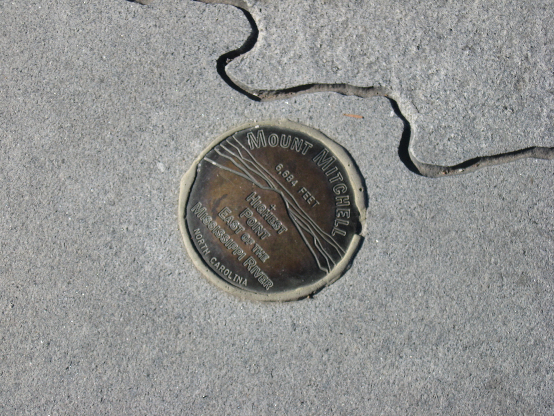
Day trip to Mount Mitchell - the highest point east of the Mississippi River.
At an elevation of 6,684 ft, Mount Mitchell is the highest point east of the Mississippi River, and it's easy and free for all to enjoy. Located about 35 miles northeast of downtown Asheville (roughly 2.5–3 hours from our cabins near Gatlinburg/Pigeon Forge/Sevierville, TN), reach it via a scenic drive: From the Smokies area, take Foothills Parkway, I-40 east, then the Blue Ridge Parkway south to NC Highway 128, which leads directly to the summit.
From the parking area, walk the short 1/4-mile paved, accessible trail to the observation deck for 360-degree panoramic views.
Due to the high altitude, plants and animals here resemble those in Canadian alpine environments. Mount Mitchell is part of the ancient Black Mountain range (over a billion years old). Six peaks in this small range rank among the East's top ten highest, including Mount Craig (6,647 ft), Balsam Cone (6,621 ft), Big Tom (6,581 ft), and Mount Gibbes (6,571 ft). Learn more at the Summit Museum (open May–October).
A little history: Originally called Black Dome for its shape, it was renamed after Elisha Mitchell, a UNC professor who explored the area in 1835 and proved it exceeded Mount Washington's height (then thought the East's tallest east of the Rockies). Mitchell tragically died at nearby Mitchell Falls in 1857 while verifying measurements.
Driving the Blue Ridge Parkway: Getting There from the TN Side
The drive itself is half the adventure! From our Smoky Mountains cabins (e.g., Sevierville or Gatlinburg area), take the scenic Foothills Parkway (a quieter, beautiful alternative to I-40) north to connect with I-40 east toward Asheville, NC. Merge onto the Blue Ridge Parkway southbound (near Milepost ~382–388 in the Asheville area), then continue to Milepost 355.3 for the exit to NC Hwy 128, which winds up to Mount Mitchell's summit. Total distance: ~120–140 miles one way; allow 3–4 hours with stops for overlooks and photos. The Parkway is famous for its gentle curves, no commercial traffic, stunning ridge-top views, tunnels, and pull-offs—perfect for a relaxed pace (speed limit 45 mph max). Watch for wildlife, fog, and elevation changes (temps drop fast!). Note: This northern access route to Mount Mitchell may face more winter closures than southern sections; southern Parkway entry near Cherokee (Milepost 469) is an alternative scenic start but adds time if heading to Mount Mitchell.
Useful tips for visiting Mount Mitchell (updated for current conditions):
- Bring layers - temperatures drop 10 - 30°F cooler than Asheville/lowlands (often windy/foggy/cloud-covered summit). Pack rain gear; the weather changes rapidly.
- Check conditions first: The Parkway and Mount Mitchell access road close frequently in winter for snow/ice. As of late February 2026, Mount Mitchell State Park is closed due to icy roads, and Parkway sections near Milepost 355 (Mt. Mitchell) are closed for winter weather. Many high-elevation areas remain closed seasonally - verify real-time at https://www.nps.gov/blri/planyourvisit/roadclosures.htm or call 828-298-0398 (Parkway) / NC State Parks site for Mount Mitchell. Recreation may be allowed at one's own risk in some closed/ungated spots.
- The park is open year-round when roads are clear (hours: Nov–Feb 7 AM–6 PM; longer in warmer months). Closed Christmas Day and for severe weather.
- Summit restaurant, gift shop, and concession stand open May–October; the museum too.
- Drive slowly - curvy roads, wildlife, weekend traffic.
- No entrance fee
For the more adventurous: Hiking near Mount Mitchell.
- Deep Gap Trail: 2-mile round-trip to Mount Craig (second-highest in East) for views through Canadian-like forest. Starts near summit picnic area.
- Balsam Trail: Easy 3/4-mile interpretive loop showing acid rain effects (near observation deck).
- Mount Mitchell Trail: Strenuous 5.5-mile one-way from Black Mountain Campground (3,600 ft gain) through hardwood to spruce-fir forests. Share with Mountains-to-Sea Trail; shuttle cars for easier return.
Directions from Ridge View Lodge - 117 mi
Directions from Appalachian Escape cabin - 116 mi