Updated Aug 2026
Rainbow Falls Trail
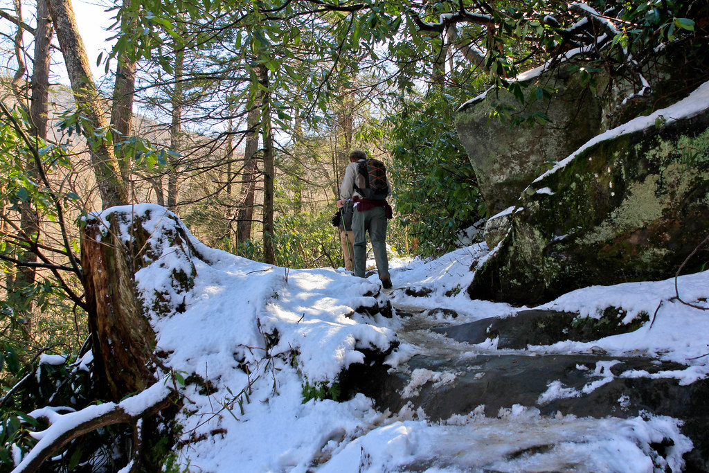
The Rainbow Falls Trail is one of the more rewarding winter waterfall hikes in the Smokies. During extended cold weather, the 80-foot waterfall can become surrounded by spectacular ice formations. The hike to Rainbow Falls is approximately 5.6 miles round trip with about 1,500 feet of elevation gain. The trail is steep and rocky, and ice can make winter conditions more challenging, so traction devices such as microspikes may be helpful.
Experienced hikers can continue beyond Rainbow Falls toward Mount Le Conte, but this is a strenuous undertaking. The full Rainbow Falls route to Mount Le Conte is approximately 13 miles round trip, and winter ice can make the higher-elevation portions of the trail particularly difficult.
Porters Creek Trail
At a lower elevation than many of the park's high-country trails, Porters Creek Trail is a good winter option when higher elevations are experiencing snow, ice, or difficult road conditions. Along the trail you'll discover historic remnants, peaceful forest scenery, and Fern Branch Falls, a 40-foot waterfall about 2 miles from the trailhead.
Many hikers turn around at Fern Branch Falls, making the waterfall a natural destination for a moderate winter outing. As with any Smokies hike, check current trail and road conditions before heading out, since winter weather can change conditions quickly.
Laurel Falls — Currently Closed
Important: Laurel Falls Trail is currently closed for rehabilitation. The National Park Service anticipates reopening the trail sometime in 2027. Check the current NPS trail conditions before planning a visit.
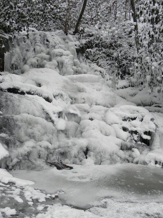
Laurel Falls is one of the most popular waterfall hikes in Great Smoky Mountains National Park, and its 80-foot waterfall can partially freeze during especially cold weather. However, the trail is currently closed while the National Park Service completes a major rehabilitation project. Do not attempt to access Laurel Falls during the closure. When the trail eventually reopens, check the NPS website for current conditions before visiting.
Alum Cave Trail to Alum Cave Bluffs
Alum Cave Trail is particularly impressive during winter. Water that normally trickles from the cliffs can freeze into long icicles, transforming Alum Cave Bluffs into an amazing natural ice display. The hike to Alum Cave Bluffs is approximately 4.6 miles round trip, with the bluffs located about 2.3 miles from the trailhead.
Inspiration Point is approximately 2 miles from the trailhead, while many hikers continue to Alum Cave Bluffs. Those looking for a longer and much more strenuous adventure can continue from the bluffs to Mount Le Conte, making the hike approximately 10 miles round trip.
Winter hikers should use extra caution on this trail. The National Park Service specifically warns of ice on the trail and potentially falling icicles in cold weather and recommends microspikes for winter conditions.
Other Lower-Elevation Winter Hiking Options
If higher-elevation trails are snowy or icy, consider choosing a lower-elevation trail instead. The Smokies have more than 800 miles of trails, and conditions can vary substantially from one part of the park to another.
For another waterfall option, the National Park Service recommends trails such as Grotto Falls, Hen Wallow Falls, and other waterfall hikes. Always check current trail conditions before setting out, particularly after winter storms.
What About Andrews Bald in Winter?
Andrews Bald offers beautiful high-elevation views and is normally a 3.6-mile round-trip hike from the Forney Ridge Trailhead near the Kuwohi parking area. However, it is not a practical winter recommendation for most visitors because Kuwohi Road (formerly Clingmans Dome Road) closes to vehicles for the winter. The 2026 seasonal schedule lists the road as open April 1 through November 29, weather permitting.
If you're specifically looking for a winter hike, choose a trail with an accessible winter trailhead rather than assuming the high-elevation areas will be reachable after a snowstorm.
Winter Hiking Tips
- Check the National Park Service website for current trail, road, and weather conditions before leaving.
- Check road conditions as well as trail conditions. Roads that are normally open year-round can still close temporarily because of snow, ice, or other hazardous weather.
- Wear moisture-wicking layers and waterproof hiking boots.
- Carry traction devices such as microspikes if icy conditions are possible.
- Use extra caution around frozen waterfalls, steep sections, and areas where falling icicles may be present.
- Start your hike early since daylight hours are shorter during winter.
- Bring plenty of water and snacks, and let someone know your hiking plans.
- Remember that a valid Smokies parking tag is required for vehicles parked for more than 15 minutes within Great Smoky Mountains National Park.
Road Conditions: Primary park roads such as Newfound Gap Road, Little River Road, and Cades Cove Loop Road are generally open year-round, weather permitting. However, winter storms can cause temporary closures. Higher-elevation Kuwohi Road (formerly Clingmans Dome Road) is seasonally closed during winter. Always check the current NPS road schedule and closures before driving to your trailhead.